Fieldwork at the 2021 Fagradalsfjall eruption in southwest Iceland
- Student experience field stories
- Brock Edwards
This work was supported by Natural Resources Canada and the Natural Sciences and Engineering Research Council of Canada. The author is indebted to Dr. Melissa Pfeffer and the staff and scientists of the Icelandic Meteorological Office for travel assistance and field support.
This past February the southwestern peninsula of Iceland began to rumble. While the region had already been experiencing heightened seismic activity for over a year, a large earthquake on February 24 signalled a new phase, with scientists and local authorities detecting the tremors of a rising magma body trying to force its way to the surface. An eruption seemed likely.
From Winnipeg I watched these developments closely, since Icelandic volcanism is the focus of my PhD work, specifically the release of mercury to the atmosphere from volcanic degassing. Since eruptions are relatively infrequent and short-lasting, my previous fieldwork focused on the ongoing gas emissions from the island’s many active geothermal fields, and I took for granted that I wouldn’t have the luck to be there for an eruption. But as the earthquakes continued and the island held its breath, all of a sudden this seemed like a possibility.
After discussions with my supervisors and our collaborators in Iceland, I requested special permission from the University’s COVID Recovery Steering Committee to travel to Iceland. Within a week my travel was approved; essential travel documents and quarantine accommodations in Iceland were arranged; and the night before my flight out, the eruption began.
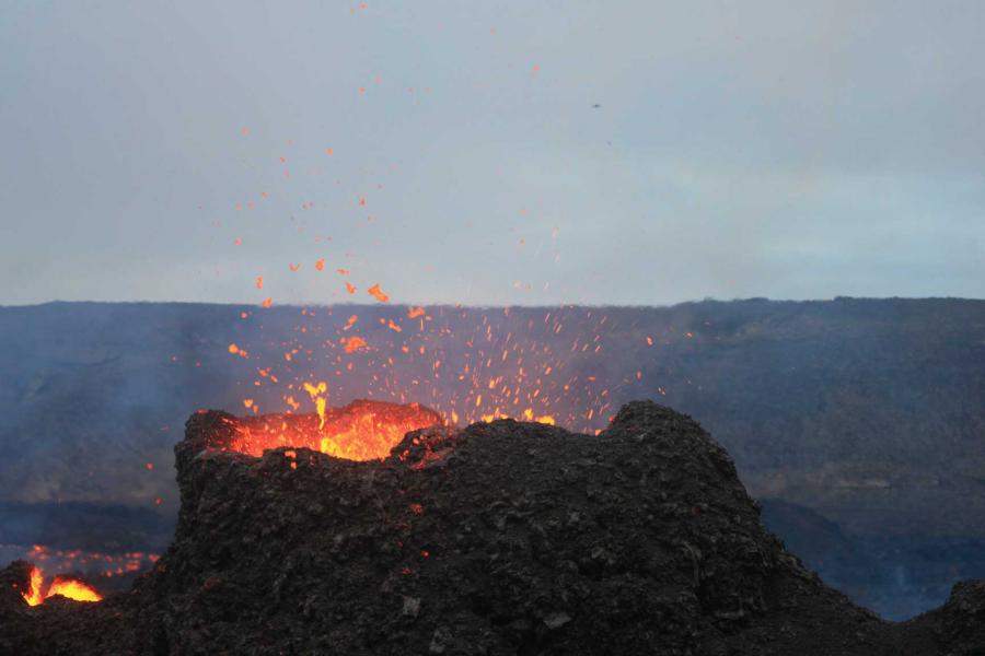
It was tough to remain in place during my five-day quarantine period in Reykjavík while being cc’d on the excited reports from scientists on the ground and seeing the first images on the news of a small, beautiful Hawaiian-style eruption in a remote valley less than an hour’s drive away. With no guarantees of the length of the eruption, I felt I was going to miss out on the action (even as I knew that I was extremely lucky to be there as it was). But after receiving the negative COVID test results that signalled my quarantine was over, I joined collaborators from the Icelandic Meteorological Office (IMO) and the University of Iceland in the field to study the toxic gases being emitted from the Fagradalsfjall eruption.
The eruption site had already become a tourist attraction, as Icelanders hiked the roughly hour-long trail from the road to witness this rare and culturally significant natural phenomenon. Scientists and search and rescue teams accessed the site from a separate route, entailing a bumpy and often muddy drive across valleys and over steep mountains formed by similar eruptions thousands of years ago. The rough ride quickly instilled in me the wisdom of eating lunch at the eruption site rather than beforehand.
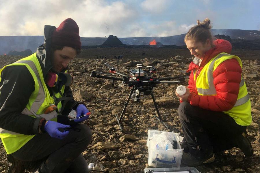
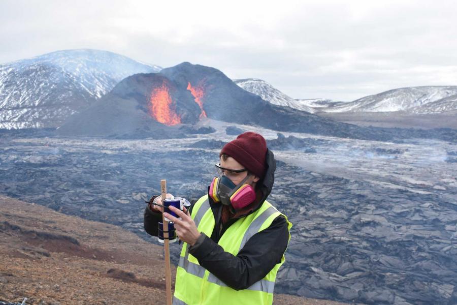
On my first visit, we set up gas monitoring instruments on the valley slopes directly opposite the main crater, downwind of the blueish volcanic cloud that set our personal gas alarms ringing. Elevated levels of sulfur dioxide and other toxic gases meant that gas masks were a must, even as they made hearing one another difficult. This combined with the muffled firework-like roar of the erupting volcano made hand signals and body language – “volcanic charades” – critical to coordinating our monitoring efforts. Along with Dr. Samuel Scott from the University of Iceland, I hiked around the entirety of the lava lake filling the small valley of Geldingadalir, setting up passive samplers on poles to collect any mercury in the air over the next few weeks. I also used air pumps to collect gaseous mercury on special activated carbon traps, and a portable mercury analyzer (the trusty Lumex) to provide real-time concentration data.
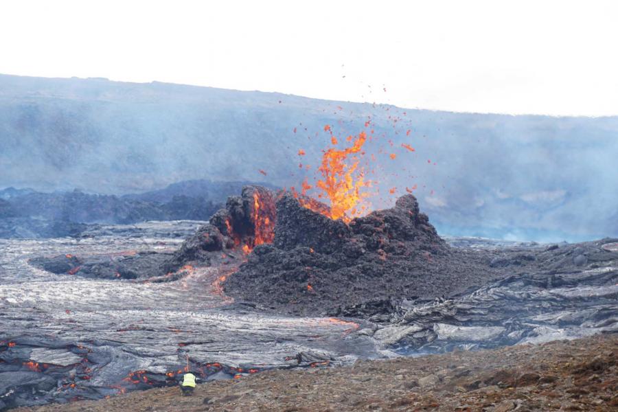
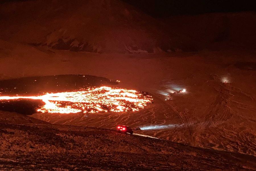
A few days later, a second fissure unexpectedly opened about a half kilometre to the northeast of the original vent. After getting the news, we raced to the eruption site to collect early-eruption data on this new vent system, setting up our instruments in a dense ground-level plume with lethal levels of sulfur dioxide (from which our masks protected us) and marvelling at the river of fast-moving lava that spilled into an adjacent valley, Meradalur. In the days that followed, additional vents opened not far from our base of operations on the eastern slopes of Geldingadalir. The lava that gushed out of these new cracks ended up destroying one of our gas monitoring instruments, several mercury passive samplers, and a webcam – all part of the bargain when working close to an active volcano! Luckily, I was able to rescue a few of my passive samplers from the rising tide of lava in the nick of time.

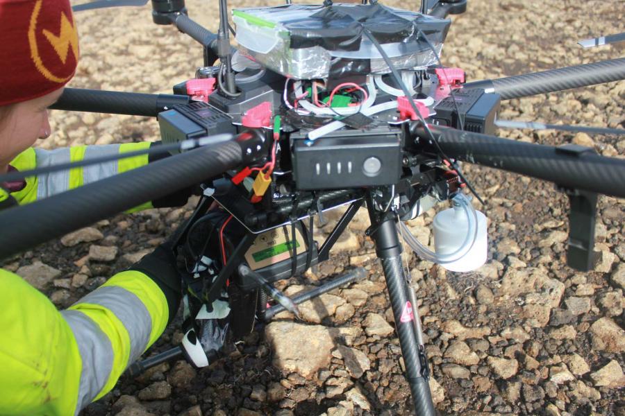
I was lucky enough to visit the eruption site a total of nine times during my month of fieldwork in Iceland, days that included mounting a mercury sampler on a drone for aerial measurements, hauling heavy equipment up steep rocky mountain slopes, and mapping out new cracks in the ground caused by the stress of deep rising magma. In spite of some setbacks, I came away with ample data on volcanic mercury emissions for my doctoral thesis work, some unbelievable photos, and new friends and colleagues to connect with again in the future. In fact, I will be returning to Iceland at the end of this summer to conduct more fieldwork while the opportunity remains. The Fagradalsfjall eruption continues, and I am told that it has changed the landscape so dramatically over such a short time that I may not recognize it, the places we once stood and took measurements now under several metres of lava.