Drone Surveys of Hudson Bay Sea Ice
- Hudson Bay System Study (BaySys)
- Maddie Harasyn
Nothing is more exciting to an ice scientist than waking up at 6 a.m., knowing that you will be setting foot on sea ice just after breakfast. My morning routine before ice sampling involves checking the drone cameras and batteries, gathering the ice surveying equipment, and eating a massive breakfast to hold me for the upcoming 6 hours of ice sampling. After this, myself and nine other scientists pull our full body immersion suits over our heads and line up to embark on our day long adventure.
This year aboard the CCGS Amundsen, I am conducting aerial surveys of the sea ice within Hudson Bay using a combination of drones and a helicopter camera. From this, I will calculate ice concentrations and classify surface features across the area in efforts to better understand ice processes in Hudson Bay during ice melt. I will also be generating elevation models to determine the surface roughness of the ice floes and ice thickness. Completing a successful drone survey in the Arctic has many associated complications – freezing temperatures, minimal GPS signal, persistent fog and high wind speeds. This has greatly limited the use of drones for Arctic applications, making these surveys unique.
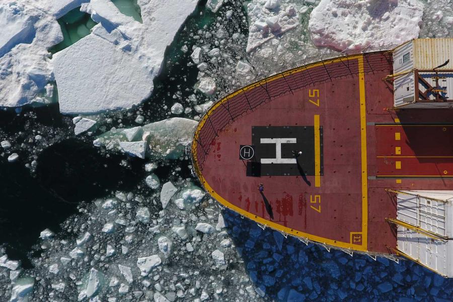
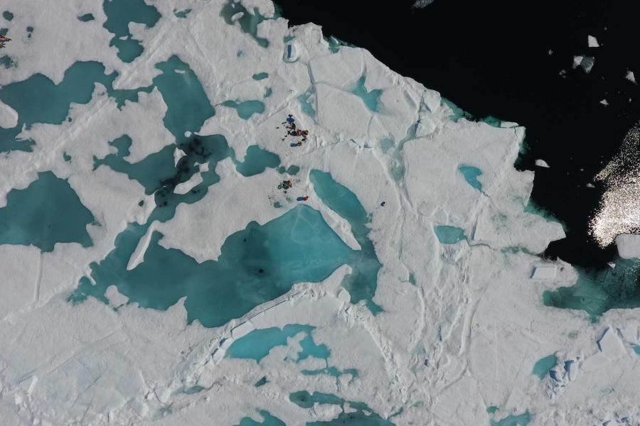

Completing a drone survey on sea ice is pretty similar to flying a drone off of land. When I first get onto an ice floe I find a flat, dry patch of ice to set up the drone and program a survey flight path for the drone to take. This way, the drone can automatically fly transects above the ice over a specific area using GPS location. The most complicated part of drone flight over ice is landing, as the ice moves under the drone while it is flying a survey. This means that when the drone positions itself to land, manual override is necessary to position it back to its original take-off position so the drone does not land in open water. This has already lead to some stressful situations up here so far, but thankfully all drones have not touched ocean water to date!