Weather and climate data is hard to come by in Canada’s northern latitudes. As a result, forecasters and researchers rely heavily on satellite data such as infra-red imagery to look at cloud and storm structures. Platforms such as CloudSat provide information on the occurrence of precipitation over a large area. Until STAR, this data had yet to be verified in an Arctic setting due to the scarcity of precipitation measurements in the Arctic. During the field campaign of STAR, the installation of a portable Doppler radar, microwave radiometer, and Doppler SODAR at Iqaluit airport, along with research aircraft flights and an increased frequency of radiosonde launches, made the verification of CloudSat over southern Baffin Island possible.
Cloud and precipitation features over southern Baffin Island were characterized during the first phase of the STAR field research project (October – November 2007). Satellite data from CloudSat and Aqua were obtained from which a number of parameters were used to examine clouds and precipitation. In addition, Doppler radar data, ground-based precipitation gauge data and surface observations were used to characterize the precipitation received at Iqaluit during the STAR field project.
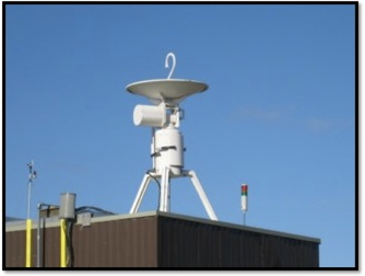
Portable X-Band surface Doppler Radar at YFB Environment Canada Weather Office
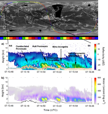
Sample CloudSat radar image (a) of clouds and precipitation over the southern Baffin Island region on 8 November 2007. Total water content (b) is also shown. The start of the granule for this case is 0554 UTC whereby the actual CloudSat pass over southern Baffin Island occurred between 0713 UTC and 0716 UTC (approximately 1 hour and twenty minutes after the start of the granule).