
Fieldwork on southern Baffin Island in 2015 was aimed at collecting more detailed geochemical and geophysical data from two documented quarry sites in the region's interior, LbDt-1 and LdDx-2. The 2015 crew included archaeologists Brooke Milne, David Landry, and Rachel ten Bruggencate, and geophysicist Mulu Serzu.
Logistics were in place for 14 days of fieldwork at the two sites. However, as in years past, the weather had different ideas...

Landry and Serzu out for a stroll in foggy uptown Iqaluit
The crew spent much of the planned two-week season grounded in Iqaluit due to poor visibility. However, this gave us the opportunity to partake in Iqaluit's Nunavut Day celebrations.

ten Bruggencate gets into the spirit of Nunavut Day
This included trying out some Northern delicacies: maktaaq, seal, and caribou.

ten Bruggencate really gets into the spirit of Nunavut Day
When the weather finally cleared, the crew was transported by helicopter to our first-priority site, LbDt-1, to begin two days of intensive geochemical and geophysical testing.

Serzu enjoys the scenery from the back seat of the helicopter en route to LbDt-1
Geophysical testing at LbDt-1 was focused on determining whether it was possible to locate the boundaries between shallow site strata using different geophysical instruments. These machines are normally used to look at much deeper deposits. To ensure an accurate and thorough picture of the site's subsurface is captured, measurements with these instruments have to be taken along a series of evenly-spaced, straight lines covering the area of interest.

Landry and Serzu setting up a grid for the ground penetrating radar at LbDt-1

Serzu and Landry setting up the electromagnetic profiler, another geophysical instrument used to look underground, with out all the hassle of digging.
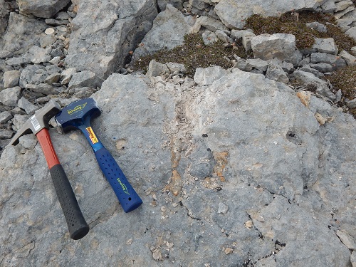
Meanwhile, geochemical testing at LbDt-1 was directed toward capturing a more representative sample of chert available in the limestone exposures along the Hone River

Chert-bearing limestone outcrop at LbDt-1
Efforts were made to sample scattered nodules of chert, as well as in situ chert deposits. In some cases, this strategy proved difficult to implement, even with the help of a chisel and 2lb hammer...

Chert embedded in limestone prior to sampling
Chert embedded in limestone after sampling